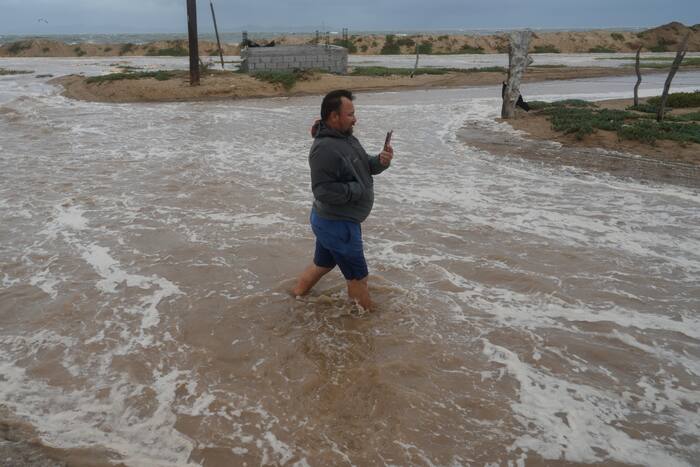
When Hurricane Polo shattered records as the longest-lasting Category 5 storm in Pacific history, meteorologists immediately pointed fingers at a familiar duo. El Nino and human-induced global warming. But a joint analysis released by World Weather Attribution and Climate Central completely reframes the narrative. Global warming didn't just play a supporting role. It did more heavy lifting than El Nino to turbocharge Hurricane Polo into a monstrous weather event.
If you think natural climate cycles are the sole driver behind extreme weather spikes, look closer at the numbers. While a powerful El Nino phase naturally warmed Pacific waters, human activity added an extra 6 mph of wind speed directly to Polo's intensity. El Nino contributed about 5 mph. That subtle shift matters. It proves that background warming now acts as a permanent tailwind for destructive storms, turning normal seasonal patterns into extreme threats.
Breaking Down the Numbers Behind Hurricane Polo
To understand how quickly things escalated, look at the timeline. Polo exploded from a standard tropical storm into a top-tier Category 5 hurricane in roughly 24 hours. That kind of rapid intensification terrifies forecasters because coastal communities lose vital evacuation time.
The study reveals specific metrics that underline the crisis:
- Ocean temperatures near the storm hit an alarming 88 degrees Fahrenheit (31.2 degrees Celsius).
- These waters ran up to 3.6 degrees Fahrenheit warmer than historical norms.
- Climate change made the environmental conditions fueling Polo roughly 23 times more likely to occur.
- El Nino made those exact conditions 14 times more likely.
Friederike Otto, a climate scientist and co-author of the study, put it bluntly. El Nino comes and goes, but climate change only escalates. Every single hurricane forming in the East Pacific now carries a baseline climate change signal that jacks up its destructive potential. As long as fossil fuel emissions continue, that baseline will keep rising.
The Physics of a Turbocharged Storm
Why did the Pacific become a breeding ground for record-breaking longevity? In the Atlantic, El Nino typically generates high-altitude wind shear that acts like a structural roadblock for developing cyclones. In the Pacific, the atmospheric response is entirely different. El Nino creates a green light by removing those wind barriers.
Layer background global warming on top of that green light, and the ocean basically floors the accelerator. Daniel Gilford, a climate scientist at Climate Central, compares the interaction to traffic mechanics. El Nino removes the red lights, while warming fuels the engine.
Even veteran meteorologists felt surprised by the findings. Brian Tang, an atmospheric scientist at the University at Albany who was not involved with the research, initially questioned how climate change could outmuscle such an extreme El Nino phase. Yet, long-term trends tell the real story. Oceans absorb over 90 percent of excess heat trapped by greenhouse gases, creating an enormous thermal reservoir that feeds modern storms.
Are Scientists Undervaluing the Warming Impact?
Science moves fast, but peer review takes time. This rapid attribution study skipped the traditional months-long review pipeline to get vital context out immediately. Because of that speed, some prominent researchers argue the findings actually underestimate reality.
Michael Mann from the University of Pennsylvania, Jeff Masters of Yale Climate Connections, and Carl Schreck of North Carolina State University pointed out that prior data sets show climate change adding even higher wind speeds to major storms. Masters referenced previous work showing climate trends tacking up to 16 mph onto Atlantic hurricanes between 2019 and 2023.
Gilford acknowledged that their methodology leaned on conservative estimates. Researchers intentionally used cautious baselines to avoid overstating claims. Even under conservative math, human activity emerged as the primary catalyst.
What This Means for Future Coastal Safety
Storms like Hurricane Polo demonstrate a terrifying new normal. When Category 5 longevity records start falling in the Pacific, emergency management strategies must adapt. Traditional flood maps, evacuation lead times, and building codes rely on historical weather models that no longer apply.
Governments and coastal municipalities cannot treat these events as statistical anomalies. Preparing for the next hyper-charged hurricane means investing heavily in resilient infrastructure, upgrading early-warning detection systems for rapid intensification, and updating zoning laws away from vulnerable flood zones. The data is clear, and waiting for perfect consensus before acting puts millions of lives at risk.