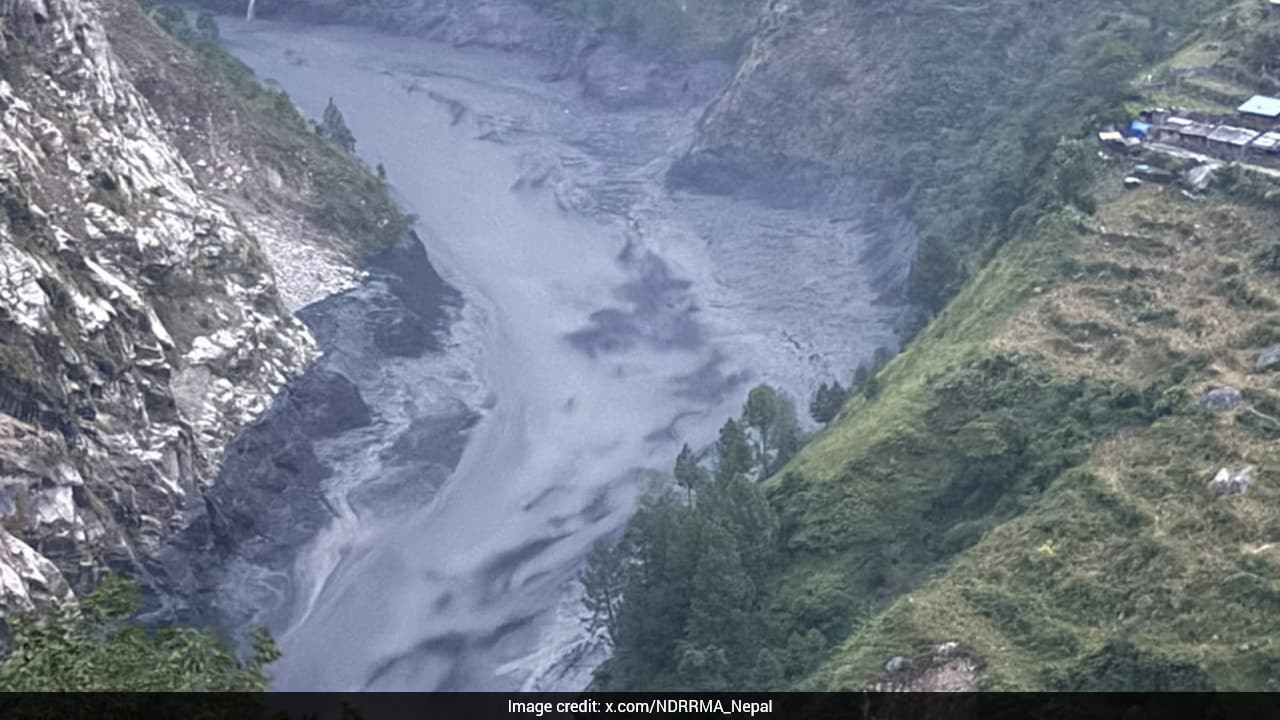
Water shouldn't turn black and grey. It shouldn't swell from 3.66 meters to over 8 meters in barely two hours. Yet, that is precisely what hit Nepal's Gorkha district when the Budhi Gandaki River surged violently, washing away more than 35 houses, multiple bridges, and a local hydropower project in Chumnubri village.
If you think this is just another seasonal monsoon disaster, you are missing the bigger picture. According to the National Disaster Risk Reduction and Management Authority (NDRRMA), there was no heavy rain to blame this time. Instead, satellite data points to a terrifying mechanism: a sudden river blockage and subsequent breach upstream.
Months after a massive August disaster killed over 1,400 people and left thousands missing, Himalayan communities face a completely different threat profile. Understanding why these sudden surges happen requires looking closer at geography, climate shifts, and the fragile nature of high-altitude waterways.
The Reality of Glacial and Landslide Blockages
Most people assume floods always arrive with dark storm clouds and relentless downpours. High-mountain hydrology doesn't work that way. When a landslide or debris dam blocks a narrow gorge, it acts like an unstable ticking clock. Water pools behind the barrier, forming an accidental lake.
When that natural dam finally gives way, the stored volume releases all at once. In Gorkha, the numbers tell the story. Between 6:30 AM and 8:40 AM, water levels skyrocketed from 3.66 meters past the 5-meter danger mark, peaking at 8.43 meters. In a narrow ten-minute window between 8:30 AM and 8:40 AM, the water rose by more than two meters.
That speed leaves zero room for error. Salleri Bazaar and Jagat Bazaar along the Budhi Gandaki absorbed the brute force of mud-heavy torrents before local warning systems could sound a proper alarm.
Why Infrastructure in the Himalayas is Struggling
Building roads, bridges, and hydropower stations in mountain terrain is an engineering nightmare. Standard flood models assume predictable seasonal flows. They don't account for massive debris flows triggered by upstream blockages that obliterate measurement centers entirely.
When the Gorkha flood washed away the local river measurement bridge, data collection stopped cold. That leaves responders flying blind during the critical first hours.
The Nepal Army deployed quick reaction teams and helicopters for aerial reconnaissance and ground rescue, airlifting stranded villagers from high-risk zones like Jagat. But rescue is always reactive. The hard truth is that remote Himalayan settlements sit in narrow valleys where early warning infrastructure is sparse or easily destroyed by the initial wave.
What Needs to Change Right Now
Living downstream in regions like the Trishuli and Budhi Gandaki river basins means accepting a volatile new normal. Traditional ecological knowledge served generations of villagers well, but modern climatic shifts and destabilized slopes require new safety protocols.
- Automated Upstream Sensors: Communities need early-warning telemetry placed far higher in remote gorges where blockages form, rather than near populated markets where it's already too late.
- Relocation Blueprints: Lower coastal settlements must enforce strict building setbacks away from active floodplains that face multi-hazard risks.
- Immediate Communication Links: Satellite-backed emergency relays are mandatory because standard cell towers and river gauges vanish the moment a debris wave hits.
The water has receded for now, leaving behind thick layers of silt and displaced families. But the underlying instability in the high Himalayas remains, and ignoring the warning signs is a luxury nobody living near these rivers can afford.


